|
|
|
Omaha Beach
Omaha was the code name for the second
beach from the right of the five landing areas of the Normandy Invasion. It was the largest, more than 6 miles (10
kilometers) between Port-en-Bessin on the east and the mouth of the Vire River on the west. The western third of
the beach was backed by a 10-foot- (3-metre-) high seawall, and cliffs surrounded the whole beach 100 feet high.
There were five exits from the beach; the best was a paved road in a ravine leading to the village of
Vierville-sur-Mer, two were only dirt paths, and two were dirt roads leading to the villages of Colleville-sur-Mer
and Saint-Laurent-sur-Mer.
The Germans under Field Marshal Erwin Rommel had built defenses to protect this area. The waters and beach were
heavily mined, and there were 12 strong points called Widerstandsnester ("resistance nests"). Many
other fighting positions were in the area, along with a big trench system. The defending forces consisted of three
battalions of the veteran 352nd Infantry Division.
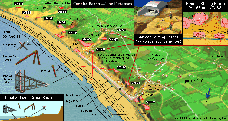
Map Of German Defense At Omaha